Updated March 29, 2023. With spring in full bloom, it’s time to break out the hiking boots once again. Whether you’re a seasoned explorer or hitting the trails for the first time, the region offers endless hiking trails for all levels. Here are seven of our favorites.
Written by Renee Sklarew, Mathina Calliope, and Nevin Martell
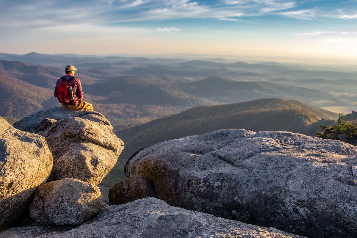
Night Hike at Old Rag
Go if: You want a new outlook on an old standby.
Address: SR600/Nethers Rd., Etlan
Mileage: 9.2 miles
Difficulty: Extremely strenuous
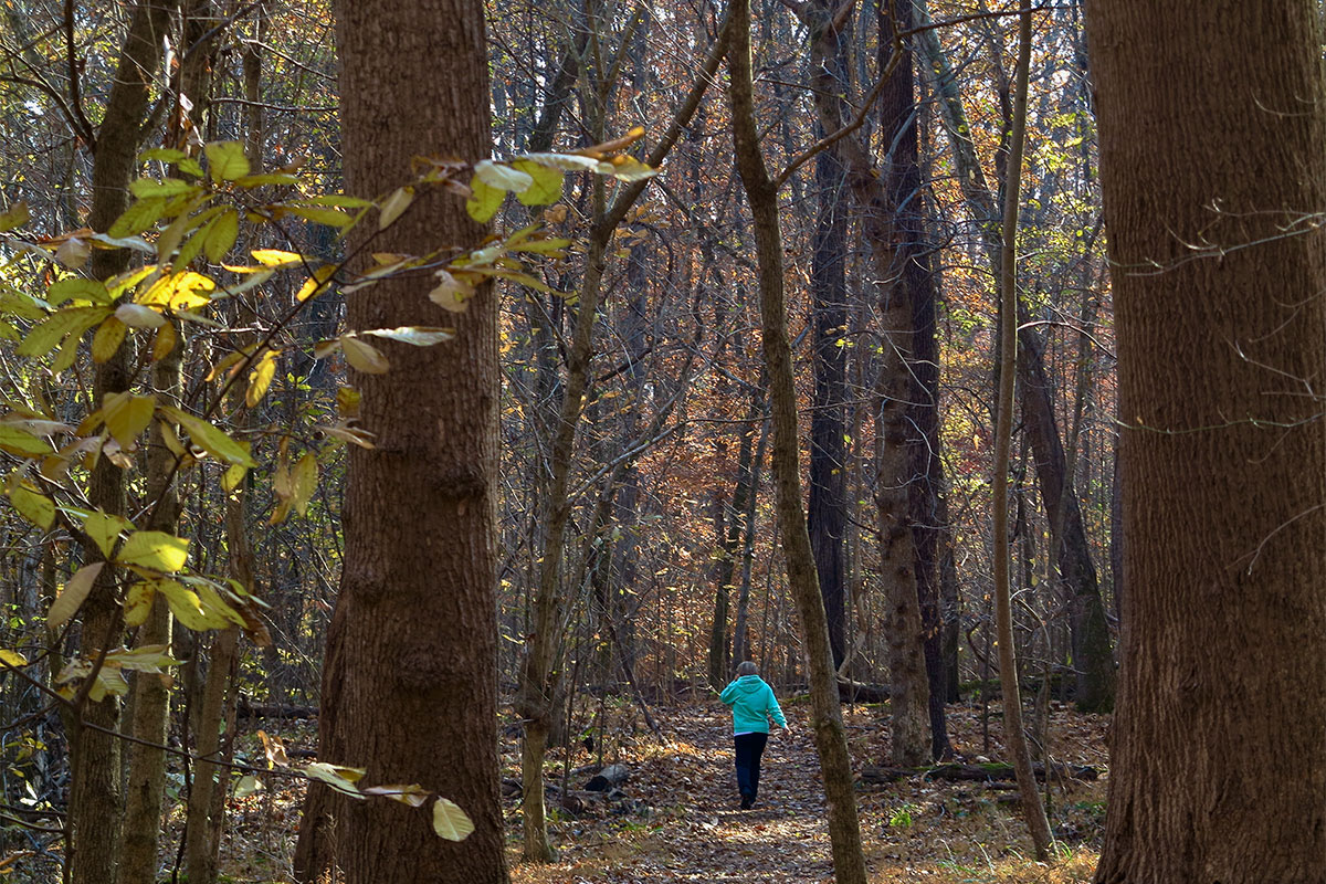
The Old Rag circuit is Shenandoah National Park’s most popular trail. Local outdoorsy folks probably know this because they’ve hiked it — and waited in lines to navigate the narrower passages. Want a quieter, more magical experience? Try it at night. Pack breakfast, at least 2 liters of water per person, and a headlamp. Set out from NoVA by 1 a.m. in summer and 3 a.m. in winter to arrive at the Old Rag entrance station with three hours to get to the top, just in time for sunrise. Don’t scrimp on time because even in daylight, this hike is the park’s most dangerous. The serious rock scramble in the last mile requires good upper body strength or a push from below by a friend.
The hike begins with a 0.8-mile road walk, so things start out slow (happily, the park service is building a new parking lot at the trailhead). Once at the official start, you’ll see the blue-blazed Ridge Trail; follow this along 2 miles of relatively benevolent but increasingly steep switchbacks. After 3 miles, start scrambling and keep doing so to the top. The summit has multiple boulders offering 360-degree views. Then, rather than head down the way you came, take the Saddle Trail (also blue-blazed), which is a fire road, back to the trailhead, Route 600, and your car.
Where to celebrate the summit: You’ll have burned through your mountaintop breakfast by the time you descend, so a stop for lunch at Warrenton’s Black Bear Bistro & Brick Oven will be well-warranted. Wood-fired pizzas, sandwiches, salads, and beer are all on the menu, but your favorite thing about this place might be the paper-towel bath you can take in its restroom.
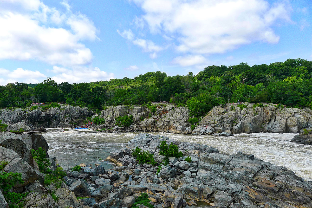
Difficult Run at Great Falls Park
Go if: You want to challenge yourself to a “difficult” hike.
Address: 8801 Georgetown Pk., McLean
Mileage: 5.1 miles
Difficulty: Intermediate to advanced
If you’re a nature lover and you live in NoVA, chances are, you’ve been to Great Falls Park. But have you ever taken on Difficult Run? The challenging 5.1-mile hike involves scrambling over boulders and making your way up 300 feet of elevation to access Great Falls Park from the less-visited side. Under the supervision of the National Park Service and part of the Gerry Connolly Cross County Trail, this wild and wondrous watershed nurtures 163 local species, including the muskrat, heron, snake, beaver, and fox. From the parking lot, carefully cross Georgetown Pike to follow Difficult Run Valley Stream (on the right side of the trail) past rapids and boulders until it reaches the confluence of the Potomac River. Take the Ridge Trail through the boulder fields until it merges with the River Trail on the way to the overlooks of Great Falls. Parts of the hike are rocky and steep, but worth it for the jaw-dropping views. Keep an eye out for rock climbers scaling the metamorphic rock cliffs, and return via the easier Matildaville Trail to Old Carriage Road.
Where to celebrate the summit: Time your visit around a show at Wolf Trap, or head to Mookie’s BBQ to sample some tasty pulled pork sandwiches and local brews in its outdoor beer garden.
Bull Run-Occoquan Trail
Go if: You don’t want to leave Rover behind.
Address: 13220 Yates Ford Rd., Clifton
Mileage: 5 miles with shorter options
Difficulty: Moderate
This popular park is beloved by hikers and their pets alike. With miles upon miles of natural surface trails for Fido, pet owners are sure to get a great workout. The Bull Run-Occoquan Trail is spread across a watershed that includes Hemlock Park, Bull Run Marina, and Fountainhead Regional Park. Begin the hike at the entrance of Hemlock Overlook Park — it’s across from Paradise Springs Winery — then take the Yellow Trail through a ravine and descend to Bull Run, a curvy stream that cuts across this flood plain. Eventually the rocky, uneven terrain flattens out among a towering stand of hemlock trees, and in the springtime, fields of bluebells. Hike as far as you want, then retrace your steps. This hike is lightly traveled and offers lots of opportunities for water play.
Where to celebrate the summit: After that rousing hike, refresh yourself and your furry friend at Paradise Springs Winery, the first winery in Fairfax County. Dogs and kids are welcome on the lawn area. For coffee, snacks, and sandwiches, bring Rover to the welcoming patio at Clifton Cafe in downtown Clifton.
Hazel Falls and Cave
Go if: You want to cross paths with a waterfall.
Address: Thornton Gap Area of Shenandoah National Park, Thornton Gap Entrance Station at US-211, Luray
Mileage: 5.3 miles out and back
Difficulty: Intermediate physical effort. There are fewer signs and markings, so be sure to bring a hiking map of the area.
Sure, those panoramic views of the Shenandoah are nice, but the national park is also resplendent with waterfalls. One of our favorites? Hazel Falls. It’s not the biggest (head to Overall Run Falls if you want to see Shenandoah’s highest waterfall), but it is harder to reach — meaning, oftentimes, you may have it to yourself when you arrive. Park at the Meadow Spring parking lot on mile marker 33.5 off of Skyline Drive. Follow the Hazel Mountain Trail until you see a sign for White Rocks Trail, then make a left. When you reach a sign for Cave Falls, turn right. It’s about a 2.56-mile hike from the parking lot to the falls, which are near a small cave. The last 0.3-mile track involves a steep, rocky descent to see these meditative falls. Bonus: Wear your swimsuit and take a dip in the swimming hole to cool off before your uphill (1,000-foot elevation gain) hike back to your vehicle.
Where to celebrate the summit:
Stay at Skyland and make it an overnight adventure with a gourmet meal in the Pollock Dining Room (fantastic views included). The Lodge is known for its Mile-High Blackberry Ice Cream Pie and blackberry pancakes. Check the monthly calendar for live music, astronomy and culinary events, and daily horseback riding.
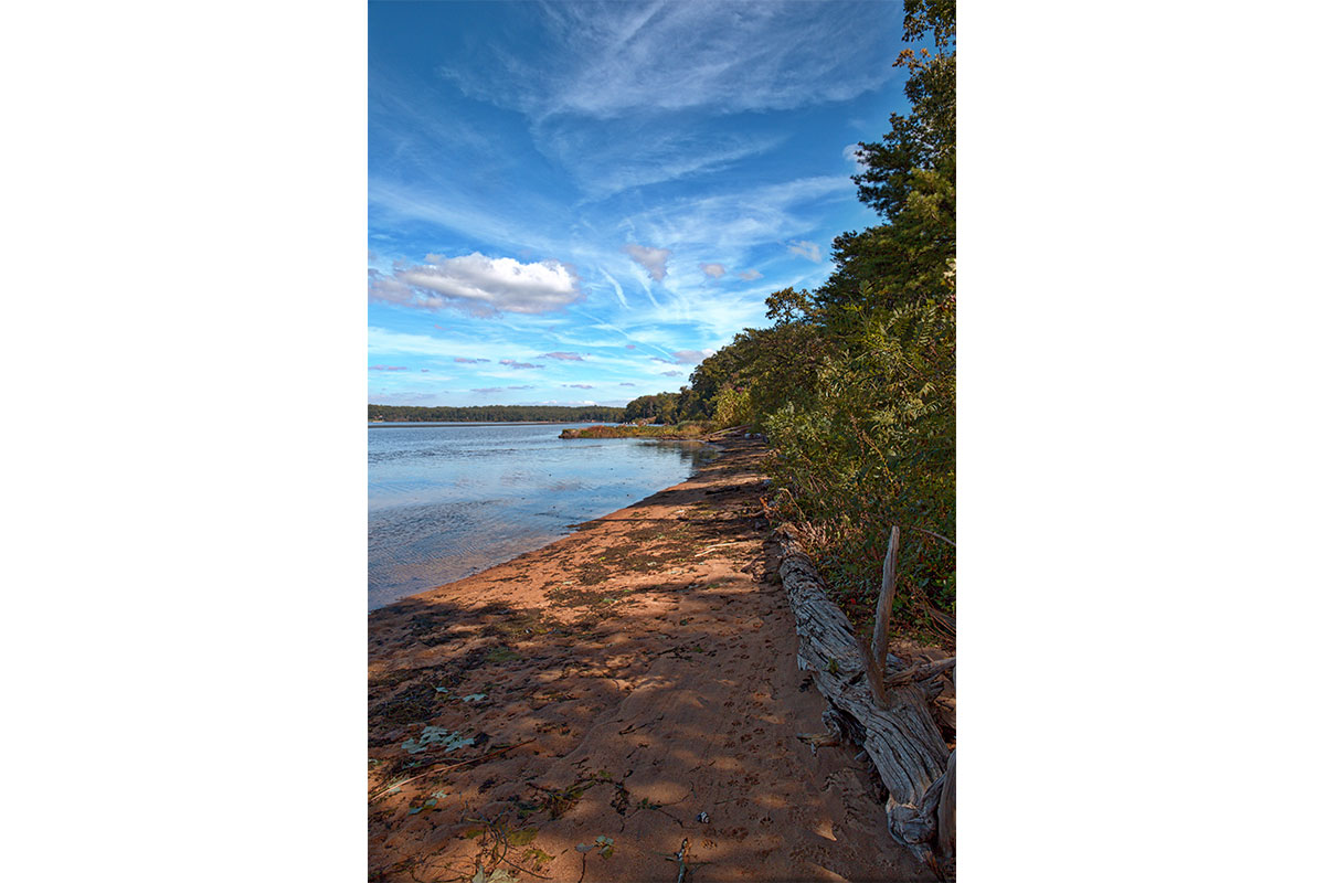
Mason Neck State Park
Go if: You want to feel patriotic and spot a bald eagle.
Address: 7301 High Point Rd., Lorton
Mileage: 2.4 miles (Bayview Trail to Wilson Spring Trail to Kane’s Creek Trail)
Difficulty: Beginner
If you pick your hikes based on where to see the best birds, Mason Neck is your park. Located in southern Fairfax County, it offers six easy-to-moderate hiking trails, but — the coolest part — there’s a wildlife refuge on-site where you’ll very likely spot bald eagles. They’re so prominent there that Mason Neck hosts an Eagle Festival every May. Start your hike at the visitor center to learn how park conservationists developed this habitat back in 1969 as the first federal sanctuary for bald eagles; the species recovery has been remarkable in the Virginia Tidewater region. Because they mate for life, you’ll often see one eagle hunting and then return to the nest so the partner can take a turn. In addition to eagles, the marsh is alive with ducks, geese, migratory songbirds, herons, and egrets. This hike offers a varied landscape of scenery, from wide-open views of Belmont Bay, wetlands filled with cattails, woodsy forests, sandy beaches, and boardwalks crossing over swamps. In addition to the variety of paths, there’s a playground, a picnic area, and a paved route for people with mobility issues.
Where to celebrate the summit: After your hike, head to downtown Occoquan for a meal at Madigan’s Waterfront, a riverside restaurant with outdoor seating and views of the Occoquan Marina.
Raven Rocks
Go if: You secretly wish you could quit your job to hike the Appalachian Trail.
Address: Snickers Gap — where Route 7 traverses the Blue Ridge Mountains
Mileage: 5.8 miles
Difficulty: Intermediate
Your co-worker’s sister did it. So did that guy you know from college. And if it weren’t for your 9-to-5, you would thru-hike the Appalachian Trail too. The path runs 2,189 miles from Georgia to Maine, and thousands of hearty souls attempt to cover the entire distance in four to six months each year. Luckily for locals, there’s a portion in Virginia you can do in a day.
Raven Rocks is the AT’s most-accessible-to-the-DMV hike. The trail crosses Route 7 several miles west of Round Hill, at Snickers Gap, about an hour’s drive from Arlington. From trailhead parking on the north side of Route 7 or a large commuter lot on the south side, head north along the white-blazed path for an out-and-back jaunt. The way is gentle at first, but you’ll soon find yourself on steep terrain because this segment is part of the trail’s infamous “Roller Coaster,” 13 of the most sawtooth miles on the AT (made so because this section of the land is squeezed by private property, forcing the trail to go straight up and down instead of along meandering switchbacks). Just under 3 miles into your journey, a sign indicates the Virginia/West Virginia border. A couple dozen yards beyond this, bare boulders offer panoramic views of the Blue Ridge and Shenandoah Mountains.
Where to celebrate the summit: Less than a third-of-a-mile south of Snickers Gap on Route 601 is a beer joint, Bear Chase Brewing Company, whose sloping lawn, dotted with Adirondack chairs aplenty, offers views back east. Dirt Farm Brewing is nearby, too. If you prefer that your fermented beverages come from grapes, check out Twin Oaks Tavern Winery, with live music every weekend, or Bluemont Vineyard, where you can make your own sangria or take a vine-to-wine tour over 40 acres of grapevines — in a vehicle.
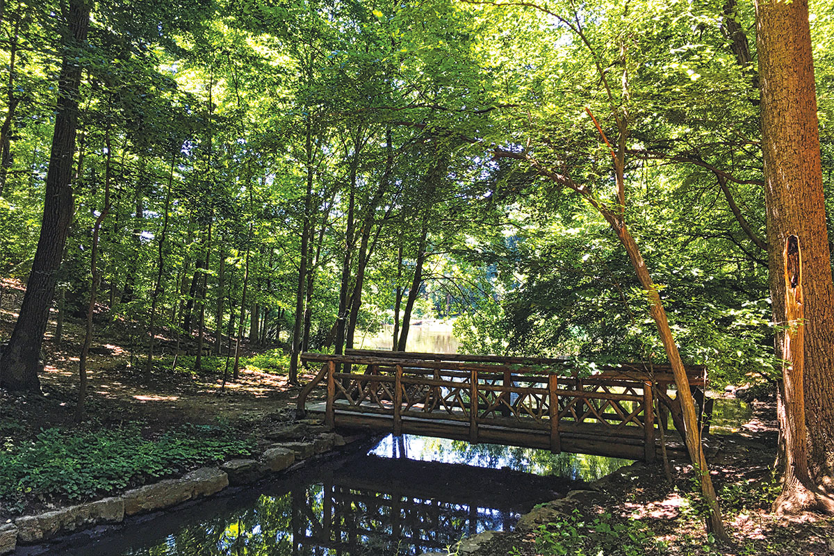
Winkler Botanical Preserve
Go if: You want your kids to believe in woodland magic.
Address: 5400 Roanoke Ave., Alexandria
Mileage: 1.2 miles
Difficulty: Beginner
When you’ve got youngsters in tow, discover the magical trails and undulating paths tucked inside Winkler Botanical Preserve. This tiny, hidden-away park in Shirlington offers the surrounding community of high-rises an escape from urban sprawl. Drive through the apartment complex and through the iron gates to enter this natural wonderland located right off I-395. The Preserve was established in 1981 by the Winkler family, who saved the old trees and planted hundreds of native species. Today, the hilly sanctuary is a meeting place for nature classes, but anyone can explore this mini nature paradise on their own. The easy 1-mile hike loops around the 2-acre pond are in view of a tumbling waterfall. Follow the paths to a wooden gateway made of tree limbs past historic Catherine Lodge. Then continue up the “high road” to reach the whimsical Hobbit House. The lower road leads back down to the river and crosses a bridge with water lilies and lotus flowers. There are no maps or trails, so expect to get a little lost, but that’s all part of the adventure.
Where to celebrate the summit: At an easy 1-mile loop, it’s not the fact that you made it to the end of the hiking trail. But, still, a 1-mile hike with young children is an accomplishment of its own kind. Grab a meal (and an adult beverage for Mom and Dad) at the nearby, family-friendly Copperwood Tavern in Shirlington.
This post originally appeared as the cover story in our April 2020 issue. For more on outdoor things to do in Northern Virginia, subscribe to our Parks & Rec newsletter.