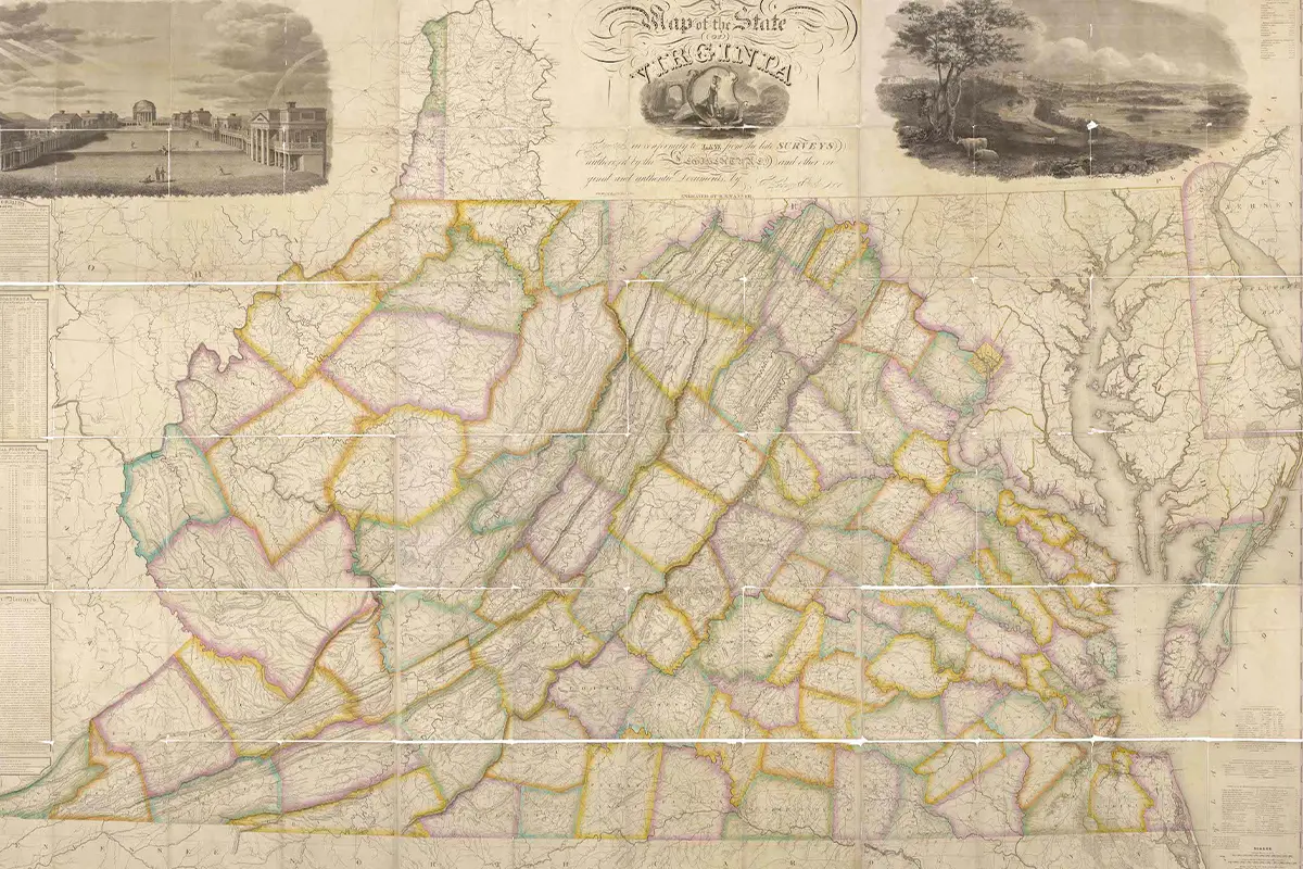
Fun fact: Did you that Virginia had one of the first official state maps in the nation? It was printed in nine sheets and measured 44 square feet.
And now you can visit a free exhibit to learn just how that map came to be.
Mapping the Commonwealth, 1816–1826 is on view at Richmond’s Library of Virginia through June 7. It “tells the story of 10 years, five governors, two principal surveyors, and one lead engraver — the time frame and team needed to create one of the first official state maps in the nation.”
The exhibit features 40 manuscript maps and highlights the painstaking work done by surveying teams working without the benefit of modern transportation and technology. They created their maps in the fields with pen and pencil, and used compasses, tripods, levels, and chains to determine county boundaries, chart water features, and describe roads.
The Library of Virginia is a free, public library located at 800 E. Broad St. in Richmond. It’s open Monday through Saturday from 8:30 a.m. to 5 p.m.
And if you can’t make the trip to see the exhibit in person, you can view the library’s videos and an online story map about the topic.
Feature image courtesy Library of Virginia