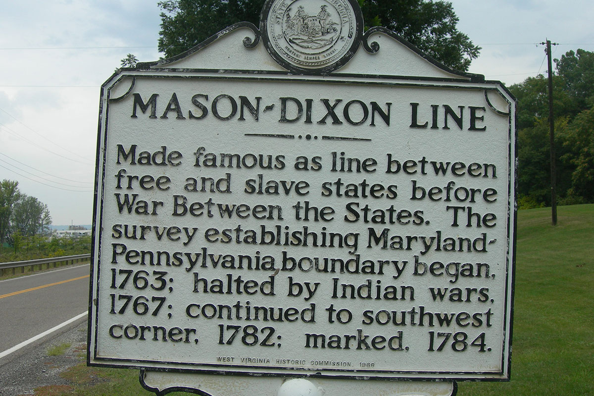
Just over 250 years ago, English surveyors Charles Mason and Jeremiah Dixon completed a job of placing stones along Pennsylvania’s crest on one side and Maryland’s on the other, creating a settled boundary between the two states.
Eventually, the physical line grew, spanning 233 miles between Pennsylvania and Maryland, as well as 83 miles between Maryland and Delaware, gaining the name of the Mason-Dixon Line. Plus, in the pre-Civil War period, it was used to draw an even longer unofficial extension separating slave states and free states.
This month, for the first time in 40 years, surveyors are starting to re-track those initial steps taken by Mason and Dixon to document and photograph the remaining monuments and markers of the line that were placed along the route along every mile. While many of the two-centuries-old markers are now missing or buried, many are still visible, resting on public and residential land, and protected by iron cages.
The Maryland Geological Survey, a unit of the Maryland Department of Natural Resources will lead professional surveying societies of both Pennsylvania and Maryland in this nearly two-year project. When completed in August 2021, the state of the markers will be inputted into the National Register of Historic Places.
If your property falls along the route, or you want to find out more information about the project, click here.
For more DMV-focused news, subscribe to one of our e-newsletters today.